Rising waters | Rooted solutions
Geohazards and natural flood management: lessons from the SUNO catchment
Ousewem is helping to highlight the need for future catchment-scale programmes to build in proportional checks on geology earlier in the process.
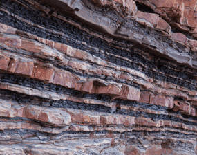
North Yorkshire’s Swale, Ure, Nidd and Ouse (SUNO) catchments, where Ousewem is focused, has varied geology. In some places this can bring challenges as well as opportunities. The British Geological Survey has highlighted North Yorkshire as one of the regions most susceptible to geohazards, including subsidence linked to soluble rock.
These risks are not new. Reports of sinkholes in the area go back over 200 years. A Hereford Journal entry from 2nd May 1821 describes how a large cavity suddenly opened in farmland near Ripon, drawing in water and soil. The account is a reminder that in certain places, the ground itself can change quickly and dramatically.
Natural flood management (NFM) measures are usually designed to “slow the flow” by holding more water on the surface, reconnecting rivers with floodplains, or using leaky dams. In most catchments this brings clear benefits to water management and quality, but in areas where soluble rock or other geohazards are present, interventions that could increase water storage or infiltration must be considered carefully.
In selecting its latest focus areas decisions were based on hydraulic modelling and evidence of flood risk and opportunity. This provided a strategic picture of where NFM could have the most benefit but it didn’t take into account what is going on underground. What detailed geological reviews have since shown, is that some local risks only become clear at the stage of planning specific interventions on the ground... perhaps to be expected when moving from high-level modelling to practical delivery. By documenting these findings, Ousewem is helping to highlight the need for future catchment-scale programmes to build in proportional checks on geology earlier in the process.
No guidance currently exists for NFM and ground stability. This is in contrast to sustainable drainage systems (SuDS) design where the national guidance lays out how no system shall lead to “an unacceptable risk of instability”. SuDS can be considered as similar to NFM as they often involve storing and attenuating flows. However given the predominately rural, lower risk setting of NFM measures, SuDS guidance can only be used as a broad aid, and if strictly implemented could prove a significant burden on project implementation.
To address these issues, Ousewem has commissioned a separate study to evaluate:
- The spatial distribution of geohazards in the Ousewem catchment and how NFM interventions can impact them.
- How specific geohazards can be identified and assessed, based on Ousewem project case studies.
- The need for national guidance, including a review of existing guides that could inform its development.
This forms part of Ousewem’s wider approach: using modelling to understand risk across the catchment, selecting focus areas for delivery, and learning as we go. Our aim is to develop NFM that aims to be an effective, safe and low-cost tool where it is appropriate, while recognising that in some places it may not be the best solution.
By sharing this work, Ousewem hopes to contribute to national discussions on how geohazards and NFM can be better aligned. We will continue to refine our approach as evidence grows, so interventions remain proportionate to both flood risk and the ground beneath our feet.